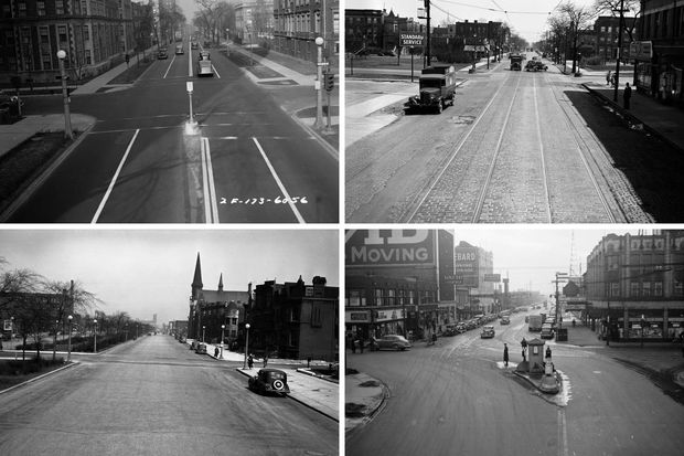
CHICAGO — If you think your neighborhood has changed since you first moved in, you should see what it looked like 60 years ago.
The University of Illinois at Chicago's digital photo collections archive has about 2,300 black-and-white scans of photos of various intersections and notable outdoor areas throughout the city from the 1920s-50s.
The photos come from the Illinois Department of Transportation and appear to have been made for the Chicago Park District's Engineering Section, according to the university.
Photos depict intersections, streets, bridges, snow removal and other traffic features in the city, mainly along major streets.
Many of the photos show the same area from a number of different angles, giving a snapshot early transportation worked and everyday life through a look at businesses, fashion, architecture and more.
We mapped out hundreds of the photos and compared them with Google Street View to show just how much Chicago has changed.
For more neighborhood news, listen to DNAinfo Radio here.