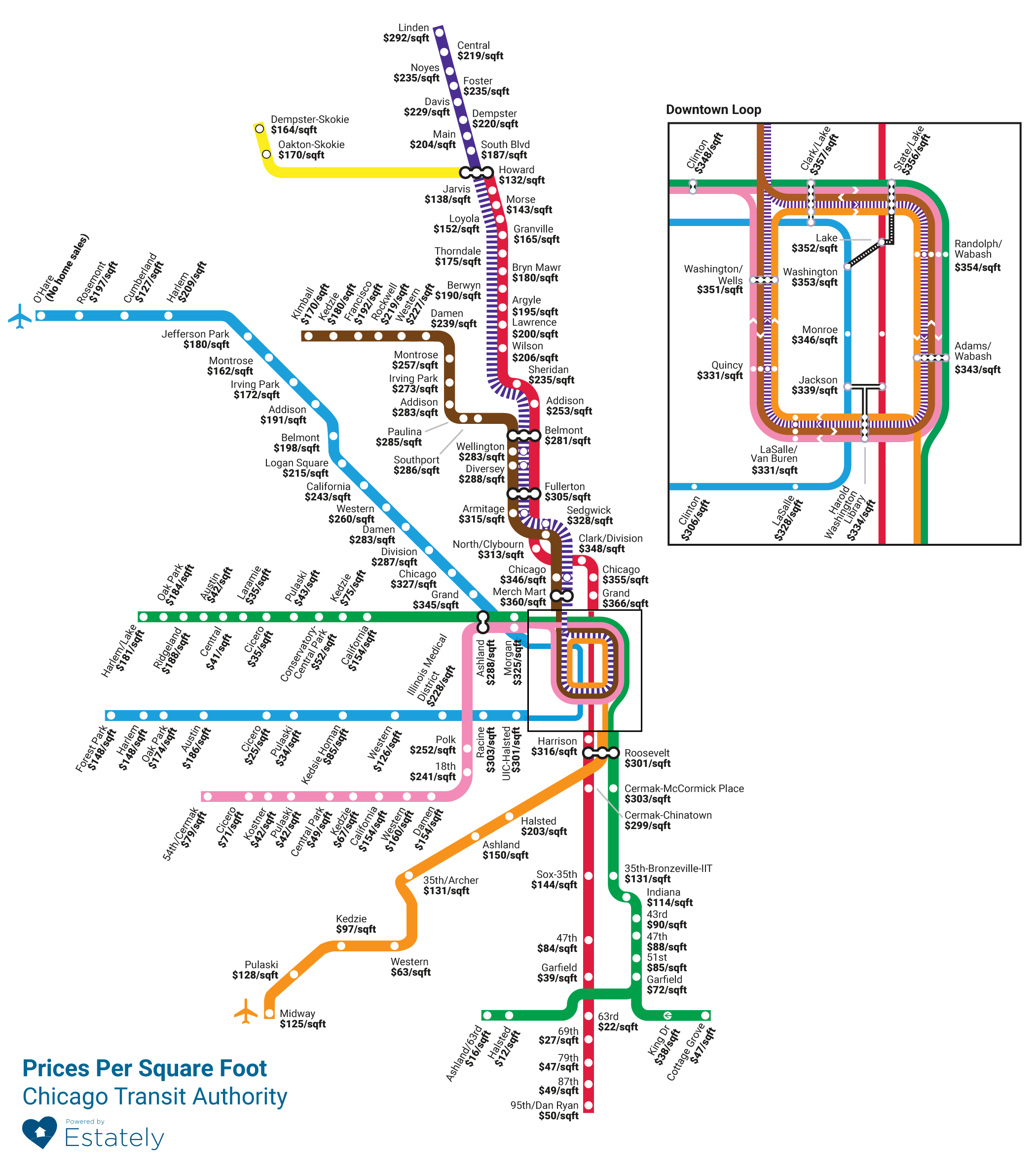
CHICAGO — If you want to buy a condo near a Downtown "L" stop, be prepared to pay.
Estately, a Seattle-based real estate firm, released a map showing how much homes sold for per square foot within a half-mile of an "L" stop.
Using six months of data, Estately found that prices range from $366 per square foot near the Grand Avenue Red Line station to just $12 per square foot near the Halsted Green Line stop in Englewood.

Data Reporter Tanveer Ali breaks down costs near the 'L.'
The "L" stops near the most expensive homes are all Downtown. Here are the top 10 "L" stops near the most expensive homes in the city, all with median home sale prices far lower than the numbers Estately crunched in a similar map for Boston, where homes near one stop go for $1,076 per square foot:
| Stop name | Median sale price | Price per square foot |
|---|---|---|
| Grand (Red) | $428,000 | $366 |
| Merchandise Mart | $410,000 | $360 |
| Clark/Lake | $400,000 | $357 |
| State/Lake | $401,531 | $356 |
| Chicago (Red) | $427,500 | $355 |
| Randolph/Wabash | $392,500 | $354 |
| Washington | $375,000 | $353 |
| Lake (Red) | $390,000 | $352 |
| Washington/Wells | $375,500 | $351 |
| Clinton | $388,750 | $348 |
The stations with the lowest priced homes per square foot were all on the South and West Sides. Here are the 10 lowest:
| Stop name | Median sale price | Price per square foot |
|---|---|---|
| Halsted (Green) | $14,750 | $12 |
| Ashland/63rd | $20,250 | $16 |
| 63rd (Red) | $27,000 | $22 |
| Cicero (Blue) | $35,000 | $25 |
| 69th (Red) | $46,797 | $27 |
| Pulaski (Blue) | $37,000 | $34 |
| Cicero (Green) | $42,550 | $35 |
| Laramie (Blue) | $49,500 | $35 |
| King Drive (Green) | $40,084 | $38 |
| Garfield (Red) | $57,500 | $39 |
Developers, both on the sales and rental sides, have been pushing for more housing projects near "L" stations throughout the city including Logan Square, West Town and Jefferson Park.
For more neighborhood news, listen to DNAinfo Radio here:


