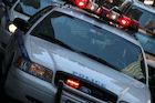
STATEN ISLAND — Google Street View cars now have another purpose — mapping gas leaks on Staten Island.
In partnership with the Environmental Defense Fund (EDF), mapping cars have been fitted with new sensors that measure methane levels in the air.
The data Street View cars collect, which was released via an interactive map Wednesday, shows that the borough averaged a leak for every mile driven by the vehicles.
"While major leaks are typically fixed very quickly, it is also fair to say that in certain places and in certain systems there is an inventory of smaller, less immediate leaks," Mark Brownstein, associate vice president and chief counsel for the EDF, said in a conference call.
"By showing how much gas is escaping, we believe we're helping to highlight the value that can be achieved by accelerating utility efforts to find and fix leaks. Not just the ones that are immediate to public health, but the ones that are chronic."
The number of leaks in Staten Island was blamed on older pipes — more than half are more than 50 years old — and the former Fresh Kills Landfill, which still had a high level of nearby leaks, the EDF said.
Since the mapped data comes from earlier in the year, National Grid said it had already replaced some of the aging pipes and fixed some leaks, but the data will help them target other problem areas.
"We're accelerating the pipeline replacement to reduce leaks and this kind of technology helps us do that even better," said Susan Fleck, vice president for Pipeline Safety at National Grid.
"We support what the EDF is doing to try to conduct research so that together we can all understand better what the methane looks like."
From January to April 2014, Street View mapping cars equipped with the methane sensing technology took to the streets of Staten Island, Boston and Indianapolis to measure leaks as part of a pilot program by EDF and Google Earth Outreach.
“Environmental quality is an issue that affects everyone. Making this information more accessible can make a meaningful difference in people’s quality of life,” said Karin Tuxen-Bettman, program manager for Google Earth outreach, in a statement.
“This pilot project is meant to explore and understand the potential for EDF and others to map and visualize important environmental information in ways that help people understand both problems and solutions.”
The data was shared with National Grid, and the EDF plans to map leaks in other cities, Brownstein said.
The EDF said that most of the leaks don't pose a threat to safety, but methane is a powerful greenhouse gas considered a significant contributor to climate change.
"It's an incredibly potent greenhouse gas," said Steve Hamburg, chief scientist at EDF. "It's really important that we reduce it to reduce the rate of climate change."