NEW YORK CITY — Just because you're surrounded by skyscrapers doesn't mean you can't get a taste of the mountains once in a while.
Residents hoping to ditch the hot pavement of New York for some natural tranquility can take a hike without getting in a car. The city's public transit system links up to dozens of hikes for outdoor enthusiasts of all ages and skill levels.
"When I started, everyone would just drive," said Michael Brochstein, 52, whose online guide to day hiking near the city has been a go-to trip source for more than a decade.
"I soon realized that there's a number of places [that] one can just get on a bus or a train and be dropped off at the trailhead."
If you don't want to hike alone, the city's premiere hiking group, the Appalachian Mountain Club, turns 100 this year and is open to the public. A $40 annual membership fee will put you in touch with thousands of members who organize and lead hikes year-round.
As its name would suggest, the group often does excursions to the Appalachian Trail, which is accessible on Metro-North's Hudson Line.
"You can get off at a stop called Appalachian Trail — and it's incredible because the trail runs right across the tracks," Brochstein said.
Of course, always follow safe hiking practices — bring snacks and plenty of water, sun protection, wear the right shoes, and let someone know where you're going.
DNAinfo.com New York has assembled a list of some of the top hikes just a short train ride from the city.
The Hikes
Difficulty: Medium-Hard
Distance: 5.5 miles
Hiking Time: 4-6 hours
Description: Often considered one of the toughest trips in the state, this mountain hike provides fantastic sweeping views of the Hudson River and nearby quarries. The trail shifts from tended trail to rocky crags quickly, so be ready to scramble quickly.
Expect a tough uphill climb for much of the hike, with a view that’s worth the work. Because much of the trail involves uphill climbs, be sure to take frequent breaks so you don't over-tire yourself before the trip back.
Travel Time: One hour
Transit Directions: Take the Metro-North Hudson Line from Grand Central Terminal and request a stop at Breakneck Ridge. Trains only run to Breakneck Ridge on weekends.
Round Trip Cost: $32.50 Adult, $16.00 Children
Difficulty: Medium
Distance: Varies
Hiking Time: Varies
Description: The famous Appalachian Trail has a segment in New York and even its own stop on Metro-North’s Harlem line. The trailhead gives you several options for different trips based on your hiking ability.
The trail itself crosses the state and eventually works its way to Bear Mountain State Park and many other parts of the state's trail system.
Travel Time: Two hours
Transit Directions: The Metro-North Harlem line leaves on weekend mornings from Grand Central Station. Take the train to Appalachian Trail station.
Round Trip Cost: $28 Adult, $14.00 Children
Difficulty: Easy
Distance: 9 miles
Hiking Time: 3 hours
Description: This flat hike is perfect for those hoping to get a good mix of natural views and New York history. It follows the route of the Old Croton Aqueduct, completed in 1842 to provide water to New York City. The hike goes from Tarrytown to Yonkers, with Metro-North stops on either end.
The hike will take you past many crumbling parts of the old aqueduct, along with Lyndhurst Castle, an American Gothic Revival structure completed in 1840, along with several other brick mansions.
Travel Time: 50 minutes
Transit Directions: Take the Metro-North Hudson line to Tarrytown station, exit on the station’s southern end and follow signs for the aqueduct route. Greystone station in Yonkers is on the other end of the hike for an easy comeback.
Round Trip Cost: Peak: $24.00 Adult, $12.00 Children. Off-Peak: $18.00, $9.00 Children
Difficulty: Hard
Distance: 4.3 miles
Hiking Time: 3.5 hours
Description: A tough alternative to the often-crowded Bear Mountain hike, the Camp Smith Trail starts nearby, but quickly slopes downward before heading up Manitou Mountain. From there, the trail offers stunning views of the Hudson Valley — not to mention the nearby Camp Smith military base.
Signs will warn you of the base in most places, but be careful not to trespass onto it — Camp Smith is an active military base and occasionally has live-gunfire training.
Travel Time: One hour
Transit Directions: Take the Metro-North Hudson Line to Peekskill Station, then take the free shuttle to the Bear Mountain Inn.
Round Trip Cost: Peak: $28.50 Adult, $14.00 Children. Off-Peak: $21.50 Adult, $11.00 Children.
Difficulty: Varies
Distance: Varies
Hiking Time: Varies
Description: Surprisingly enough, there are six major hiking trails within the Staten Island Greenbelt that will surround you with nature. The greenbelt is a protected swath of forest in the middle of suburban Staten Island with a variety of hikes for all levels.
The Greenbelt is a more urban hike, but there are still areas of dense brush where you can get lost. Most trails end near either a parking lot or a bus stop, making it easy to head home when you're done for the day.
Travel Time: 40 minutes
Transit Directions: From the Staten Island Ferry, take the X10C bus towards Port Richmond, get off at North Gannon Avenue and transfer to the S54 to Brielle Avenue. Follow signs for High Rock Park.
Round Trip Cost: $4.50
Ramapo Torne/Raccoon Brook Hills Trail Loop
Difficulty: Medium
Distance: 6.5 miles
Hiking Time: 4 hours
Description: A classic Bear Mountain Park hike with soft inclines and several panoramic vistas of the Torne Valley, the trail weaves in and out of contact with human infrastructure, so be ready to see power lines and the occasional road.
The trails on this loop meet up with other ones traversing bear mountain, giving you the opportunity to customize your own hike. Several old wooden bridges connect parts of the trail. Be sure to read any signage nearby to make sure they're safe to cross.
Travel Time: One hour
Transit Directions: Take the New Jersey Transit Port Jervis Line from Penn Station to Sloatsburg Station. Follow signs for Pine Meadow or Seven Hills trail.
Round Trip Cost: $12.25 Adult, $6.00 Children
Difficulty: Easy
Distance: 1 mile
Hiking Time: 1 hour
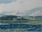
Description: A relaxing walk along the Long Island Sound awaits just a few stops outside of the city. This hike takes you alongside the 1838 Greek Revival mansion that was the boyhood home of John Jay, along with a colorful meadow and marshes. Aside from rows of white houses, the area is known for frequently passing ships and sailboats. Be sure to bring bug spray if you're going in the evening — this hike route gets a lot of mosquitos as the sun sets.
Travel Time: 30 minutes.
Transit Directions: Take Metro-North’s New Haven Line to Harrison Station, walk down Purdy Street, turn left on Park Avenue, then right on Boston Post Road.
Round Trip Cost: Peak: $21.00 Adult, $10 Children. Off-Peak: $15.50 Adult, $8.00 Children.
Difficulty: Easy-Medium
Distance: 4 miles
Hiking Time: 2.5 hours
Description: This gradually descending trail will take you to the edge of the Hudson River and back, giving some great views. About halfway through, you’ll walk by a brick mansion originally built in 1897. The mansion belonged to the prominent Livingston family until 1938, when it and the land around it became the preserve.
The trail splits in two early on, with both paths leading to cliffside vistas over the Hudson.
Travel Time: One hour
Transit Directions: Take Metro-North’s Hudson Line to Manitou Station, follow signs for the trail.
Round Trip Cost: Peak: $32.50 Adult, $16 Children. Off-Peak: $24.50 Adult, $12.50 Children.